Hazel Landing to Olivers Woods
Surprisingly scenic, this float meanders past Town Run Bike Trails, under the 465-N bridge, ending as it wraps quietly behind the Keystone shopping area to the Oliver’s Woods take out.

About the Float
Nora/86th Street Gauge

Current Weather
Currently: A Few Clouds, 76°F, Winds SE at 7 MPH Today: Partly cloudy, with a low around 71. Calm wind. Tonight: A 30 percent chance of showers and thunderstorms, mainly after 3pm. Partly sunny, with a high near 90. Heat index values as high as 100. Light south southwest wind increasing to 5 to 9 mph in the morning.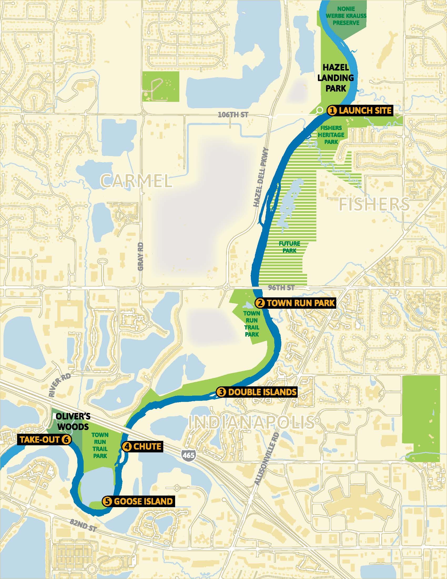
Hazel Landing Park
39.94167,-86.06932Canoe/Paddle Launch. Easy walk from parking area to launch. Parking lot lit for early and after hours drops.
Oliver's Woods
39.91439,-86.09642Canoe/Paddle Access. A 100 yard drag from ramp and parking lot. Parking lot lit for early and after hours drops.
Float Specifics
Float Duration
1.5 to 2 hrs
Float Length
3.4 river miles
Approximate Shuttle Time
5-10 minutes
Points of Interest
Town Run Park
Secondary paddle access point.
Double Islands
The river runs fast through here. At a depth of 4′ or more, the line between the islands is passable. River left is passable at lower levels. There is a downed tree on the bank of river left that should be avoided. There is a shallow riffle after the islands where you may need to walk your boat at lower water levels.
The Chute
Passable on River Left. There are many strainers here, so be prepared to duck to avoid them.
Goose Island
This public island in an abandoned quarry is a perfect spot for a lunch stop. The current takes you due west, then turns north towards Oliver’s Woods.
Canoe/Paddle Launch. Easy walk from parking area to launch. Parking lot lit for early and after hours drops.